
Fort Lauderdale Flood Zones Explained: AE, VE, AH, AO and X
September 23, 2026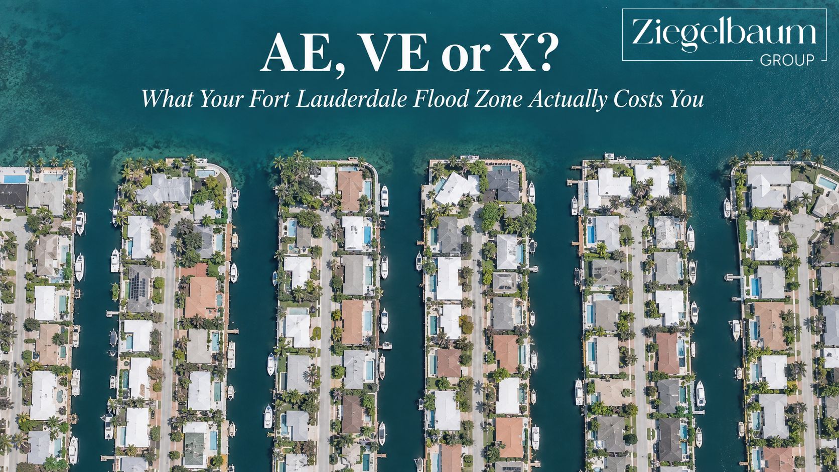 Insights from Josh & Karla Ziegelbaum – Ziegelbaum Group at Compass
Nothing kills a Fort Lauderdale deal faster than a flood zone nobody checked. Not the roof. Not the kitchen. The zone.
Here is what the letters actually mean, where to look yours up, and the 15% discount most homeowners in this city have no idea they already qualify for.
The Short Answer: What Flood Zone Is My Fort Lauderdale Home In?
Fort Lauderdale properties fall into one of two broad categories. High-risk zones — AE, AO, AH and VE — are areas the federal government maps as having a 1% or greater chance of flooding in any given year. Zone X is everything else: low to moderate risk.
The City of Fort Lauderdale puts it plainly: “Any place with a 1% chance or higher of experiencing a flood each year is considered high risk.”
Your zone is set by address, not by neighborhood. Two homes on the same street can sit in different zones. You look yours up on the City’s GIS Flood Zones App or the FEMA Map Service Center — both are free.
Fort Lauderdale Flood Zones: The Facts
- Zones found in Fort Lauderdale: AE, AO and AH inland; VE along the coast; X for low and moderate risk areas.
- High-risk definition: a 1% or greater chance of flooding in any year — what people used to call the “100-year floodplain.”
- Fort Lauderdale’s CRS rating: Class 7, which on FEMA’s current schedule earns a 15% reduction in NFIP flood insurance premiums. Under Risk Rating 2.0 that discount applies to all eligible properties in the city regardless of flood zone.
- What sets your premium: not the zone. Under FEMA’s Risk Rating 2.0, NFIP premiums are rated on “flood types, distance from a flooding source, frequency of flood, elevation, and the cost to rebuild a property.”
- Where to look up your zone: the City’s GIS Flood Zones App, or the FEMA Map Service Center for the effective Flood Insurance Rate Maps.
- Elevation certificates: required in Fort Lauderdale for all new construction, substantial improvements, and any addition to an existing structure.
- Who prepares them: the City does not. Elevation certificates are prepared by licensed surveyors, architects and engineers, then submitted to the Floodplain Manager during permitting. The City retains a copy on file.
- City floodplain contact: 954-828-4255.
- FEMA Mapping and Insurance eXchange: 1-877-336-2627.
That CRS discount is the one most people miss. It is automatic — you do not apply for it — and it exists because the City does floodplain work above the federal minimum. If your premium quote does not reflect it, ask your agent why.
What Is Flood Zone AE?
Zone AE is the most common high-risk designation in Fort Lauderdale. FEMA defines it as “the base floodplain where base flood elevations are provided.”
In plain terms: FEMA has mapped this area as having a 1% annual chance of flooding, and has calculated a specific height — the Base Flood Elevation, or BFE — that floodwater is expected to reach. Everything about how your home is treated for insurance and permitting flows from where your lowest floor sits relative to that number.
A home built two feet above BFE and a home built two feet below BFE can be on the same block in the same zone and have completely different insurance outcomes. The zone tells you the neighborhood’s risk. The elevation certificate tells you your house’s.
What Is Flood Zone VE?
Zone VE is the coastal high-risk zone. FEMA defines it as “coastal areas with a 1% or greater chance of flooding and an additional hazard associated with storm waves.”
That last clause is what separates VE from AE, and it matters more than most buyers realize. VE assumes not just standing water but wave action — which drives stricter construction requirements and meaningfully higher insurance costs than an AE property a few blocks inland.
If you are shopping directly on the beach side, assume VE until the map tells you otherwise.
What Are Zones AH and AO?
These are the shallow-flooding zones, and they show up inland in Fort Lauderdale.
- Zone AH: “areas with a 1% annual chance of shallow flooding, usually in the form of a pond, with an average depth ranging from 1 to 3 feet.”
- Zone AO: “areas with a 1% or greater chance of shallow flooding each year, usually in the form of sheet flow, with an average depth ranging from 1 to 3 feet.”
The difference is how the water behaves. AH is water that pools and sits. AO is water that moves across the surface. Both are officially high-risk, and both trigger the same insurance requirements as AE.
What Is Flood Zone X?
Zone X is where most buyers want to be, but the label covers two different things and the distinction is worth knowing.
- Shaded X: “moderate flood hazard areas… between the limits of the base flood and the 0.2-percent-annual-chance (or 500-year) flood.”
- Unshaded X: “areas of minimal flood hazard, which are the areas outside the SFHA and higher than the elevation of the 0.2-percent-annual-chance flood.”
Neither is a guarantee. Zone X means lower mapped risk, not no risk — and South Florida has a long memory of streets that flooded despite being outside a high-risk zone. What Zone X changes is the requirement and the price, not the weather.
Fort Lauderdale Flood Zones at a Glance
| Zone | Risk level | What it means | Where you see it in Fort Lauderdale |
|---|---|---|---|
| VE | High | 1% annual chance plus storm wave hazard | Coastal / beachfront |
| AE | High | 1% annual chance, Base Flood Elevation assigned | Most common high-risk zone citywide |
| AH | High | Shallow ponding, 1–3 ft average depth | Inland low-lying pockets |
| AO | High | Shallow sheet flow, 1–3 ft average depth | Inland low-lying pockets |
| X (shaded) | Moderate | Between the 1% and 0.2% flood limits | Transitional areas |
| X (unshaded) | Minimal | Outside the SFHA, above the 0.2% flood elevation | Higher-elevation inland areas |
How to Look Up Your Property’s Flood Zone
Three free options, in the order we actually use them:
- The City of Fort Lauderdale GIS Flood Zones App. Best first stop for a Fort Lauderdale address. It shows both effective and preliminary maps.
- The FEMA Map Service Center. This is the official source for the effective Flood Insurance Rate Maps and downloadable FIRMette documents — the version a lender or insurer will want.
- Call FEMA directly. The Mapping and Insurance eXchange is 1-877-336-2627 if the maps are ambiguous for your parcel.
One caution that costs people money: the zone shown on a listing, a tax record or a third-party site is not authoritative. Pull it yourself, by address, before you write an offer.
Is Flood Insurance Required in Fort Lauderdale?
It depends on two things: your zone and your mortgage.
If your property sits in a Special Flood Hazard Area — Zones AE, AO, AH or VE — and you have a mortgage from a federally regulated or insured lender, flood insurance is generally required as a condition of the loan. In Zone X it is typically not federally required, though individual lenders can still require it, and plenty of Zone X owners in this city carry it anyway.
Homeowners insurance does not cover flood. That surprises people every single year.
This is general information, not insurance advice. Confirm your specific requirement and pricing with your lender and a licensed Florida flood insurance agent.
Why Your Flood Zone Is Not What Prices Your Policy
This is the part that trips up almost everyone, including plenty of agents.
Under FEMA’s Risk Rating 2.0, the flood zone on the map no longer sets your NFIP premium. FEMA retired the old zone-based rate tables and now prices each property individually.
The variables FEMA rates on are “flood types, distance from a flooding source, frequency of flood, elevation, and the cost to rebuild a property.”
Read that list again, because two of those are not on your flood map. Distance from a flooding source is measured property by property, not zone by zone. And cost to rebuild means a more expensive house costs more to insure against flood even at identical risk.
So what is the zone still for? Three things, and all three still matter:
- Your lender. The mandatory purchase requirement is still tied to the Special Flood Hazard Area, not to your individual rate.
- Your permits. The City’s construction and substantial-improvement rules are tied to the zone and the Base Flood Elevation.
- Your resale. The next buyer’s lender pulls the same map you did.
What the zone is no longer is a price tag. Two homes in the same AE zone, one on the canal and one four blocks inland, can price very differently — and the map will not tell you which is which.
The 15% Discount Most Fort Lauderdale Homeowners Don’t Know About
Fort Lauderdale participates in FEMA’s Community Rating System, a voluntary program that rewards cities for floodplain management above the federal minimum. The City currently holds a Class 7 rating.
On FEMA’s current CRS schedule, Class 7 earns a 15% reduction in NFIP flood insurance premiums. You do not apply for it. It is built into how policies in the city are rated.
Fifteen percent is not a rounding error. On a $2,000 annual premium that is $300 a year. On $6,000 it is $900 a year — every year you own the house, with no paperwork and no application.
And here is the part worth a phone call. Under Risk Rating 2.0, FEMA applies the CRS discount to all eligible properties in the community regardless of flood zone. The City of Fort Lauderdale’s own flood page still describes the older structure, where the discount was larger inside high-risk zones and smaller in Zone X.
We are not in a position to tell you which figure your insurer has applied to your specific policy. We are telling you it is worth asking — particularly if you are in Zone X and were told you only qualify for the smaller number.
What Is an Elevation Certificate and Do You Need One?
An elevation certificate is a surveyed document recording the exact height of your home’s lowest floor relative to the Base Flood Elevation. It is prepared by a licensed surveyor, architect or engineer — not by the City.
Whether you need one depends entirely on what you are trying to do, and this is where most of the advice online is now out of date.
For building permits: still required. Fort Lauderdale requires an elevation certificate “for all new construction and substantial improvements, as well as for any additions being made to an existing structure.” That has not changed.
For flood insurance: no longer required. FEMA is explicit: “An Elevation Certificate (EC) will no longer be required to purchase coverage under Risk Rating 2.0.” FEMA uses its own elevation data to rate the policy.
But it can still be worth submitting one. FEMA allows that “a property owner may choose to provide an EC and submit it to their NFIP insurer to determine if it will affect their rate.” If your home sits meaningfully higher than FEMA’s data assumes, that certificate is how you prove it.
One practical note that saves people real money: the City retains a copy of every elevation certificate submitted during permitting. If permitted work was done on the house before you owned it, one may already exist. Call 954-828-4255 and ask before you pay a surveyor.
Flood Zones in Imperial Point
Imperial Point runs from McNab Road south to NE 56th Street, and from Federal Highway west to NE 18th Avenue — roughly 1,470 homes built between 1960 and 1967.
What matters for flood is that the neighborhood holds two genuinely different kinds of property. There are canal-front homes with seawalls, docks and ocean access, and there are interior blocks several streets from any water at all. They do not carry the same flood profile, and under Risk Rating 2.0 they will not price the same either, because distance from a flooding source is one of the variables FEMA rates on.
There is no single Imperial Point flood zone. That is why “does Imperial Point flood” has no useful answer at the neighborhood level. Two homes four blocks apart can be mapped differently — and the canal-front one is not automatically the more expensive one to insure. A 1960s house sitting low on an interior lot can rate worse than a raised home on the water.
If you are buying here: pull the zone by address on the City’s GIS app before you write, and ask whether an elevation certificate already exists from prior permitted work. These houses are sixty years old and most have been through a permitted renovation at some point.
For the access side of waterfront here — bridge clearance out toward the Intracoastal — see our breakdown of the McNab Road bridge. For everything else about the neighborhood, start with our complete Imperial Point guide.
Flood Zones in Coral Ridge and the Waterfront Neighborhoods
Coral Ridge runs from East Sunrise Boulevard north to East Oakland Park Boulevard, and from the Intracoastal Waterway west to the Middle River — roughly 1,350 single-family homes with water on two sides.
Water on two sides is the whole point. A home backing a canal off the Intracoastal and a home over near the Middle River are two different flood conversations, and the elevation range across the neighborhood is wide. The name on the street sign tells you nothing about the map.
The same holds across Bay Colony, The Landings, Rio Vista and Lauderdale Harbours. Every one of them is a mix.
The pattern we see over and over: a buyer assumes a whole neighborhood carries one risk profile because it carries one name, gets a real premium quote late in due diligence, and then has to renegotiate from a weak position. Pulling the zone by address at the start costs nothing and takes two minutes.
If you are comparing waterfront options, our side-by-side of Coral Ridge vs. Bay Colony vs. The Landings walks through how these neighborhoods differ beyond price.
What We Tell Clients Before They Make an Offer
Four things, every time:
Pull the zone yourself, by address, before the offer — not during inspection. Finding out during due diligence turns a negotiation into a scramble. Finding out before you write lets you price it in.
Ask the seller for the elevation certificate in writing. If one exists, it costs you nothing. If it does not, call the City at 954-828-4255 before you order a survey — they may already have one on file from prior permitted work.
Get a real flood quote, not an estimate. Two houses on the same street, same zone, can price very differently based on elevation. An estimate from a listing sheet is not a quote.
Confirm the CRS discount is applied. Fort Lauderdale’s Class 7 rating is worth 15% in a high-risk zone. It should already be in the number. Ask.
None of this is exotic. It is just the part that gets skipped when everyone is moving fast — and it is the part that shows up later as a renegotiation or a surprise at closing.
Frequently Asked Questions About Fort Lauderdale Flood Zones
What flood zone am I in in Fort Lauderdale?
Look up your specific address on the City of Fort Lauderdale GIS Flood Zones App or the FEMA Map Service Center. Fort Lauderdale contains Zones AE, AO, AH and VE as high-risk areas, and Zone X for low to moderate risk. Zones are assigned by address, not by neighborhood.
What does flood zone AE mean?
Zone AE is a high-risk area with a 1% or greater chance of flooding in any given year, where FEMA has calculated a specific Base Flood Elevation. It is the most common high-risk designation in Fort Lauderdale.
What is the difference between Zone X and Zone AE?
Zone AE is high-risk with a 1% or greater annual chance of flooding and an assigned Base Flood Elevation. Zone X is low to moderate risk, outside the Special Flood Hazard Area. Flood insurance is generally required for mortgaged properties in Zone AE and generally not federally required in Zone X.
What is flood zone VE?
Zone VE is the coastal high-risk zone: a 1% or greater annual chance of flooding plus an additional hazard from storm waves. It carries stricter construction requirements than inland high-risk zones.
Does my flood zone determine my flood insurance premium?
No. Under FEMA’s Risk Rating 2.0, the flood zone on the map no longer sets the NFIP premium. FEMA rates each property individually on flood types, distance from a flooding source, frequency of flood, elevation, and the cost to rebuild the property. The zone still determines whether your lender requires coverage and which construction rules apply, but it is not the price.
Is flood insurance required in Fort Lauderdale?
If your property is in a Special Flood Hazard Area, meaning Zones AE, AO, AH or VE, and you have a mortgage from a federally regulated or insured lender, flood insurance is generally required. In Zone X it is typically not federally required, though a lender may still require it. Confirm with your lender.
Does Fort Lauderdale offer a flood insurance discount?
Yes. Fort Lauderdale holds a Class 7 rating in FEMA’s Community Rating System, which on FEMA’s current CRS schedule earns a 15% reduction in NFIP flood insurance premiums. It is applied automatically, with no application. Under Risk Rating 2.0 FEMA applies CRS discounts to all eligible properties in the community regardless of flood zone, so Zone X owners in Fort Lauderdale should confirm which figure their insurer has applied.
What is an elevation certificate and do I need one?
An elevation certificate is a surveyed document showing the height of a home’s lowest floor relative to the Base Flood Elevation. Fort Lauderdale still requires one for all new construction, substantial improvements and additions to existing structures. For flood insurance it is no longer required: FEMA states that an Elevation Certificate will no longer be required to purchase coverage under Risk Rating 2.0, though an owner may still submit one to their insurer to see whether it affects the rate.
Does the City of Fort Lauderdale keep elevation certificates on file?
Yes. Elevation certificates submitted during the permitting process are retained on file by the City. If prior permitted work was done on a property, a certificate may already exist. The floodplain office can be reached at 954-828-4255.
Does a flood zone affect home value?
It affects carrying cost, which affects what buyers will pay. Required flood insurance is a monthly number a buyer factors into what they can offer. Since FEMA now rates by property rather than by zone, two homes in the same zone can carry very different premiums, so the zone alone is a poor predictor of value impact.
Does Imperial Point flood?
There is no single Imperial Point flood zone. The neighborhood contains both canal-front homes with ocean access and interior blocks several streets from water, and flood zone designations vary by address within it. Look up the specific property on the City of Fort Lauderdale GIS Flood Zones App rather than relying on the neighborhood name.
Sources
- FEMA — Risk Rating 2.0: NFIP’s Pricing Approach (how premiums are set, and why the zone no longer sets them)
- FEMA — Risk Rating 2.0 Frequently Asked Questions (elevation certificates under the new rating system, CRS discounts regardless of zone)
- FEMA — Community Rating System (the class-to-discount schedule: Class 7 = 15%)
- FEMA — Flood Map Service Center (the effective Flood Insurance Rate Maps, by address)
- City of Fort Lauderdale — Flood Risk Information (zones present in the city, the high-risk definition)
- City of Fort Lauderdale — Community Rating System (the City’s Class 7 rating)
- City of Fort Lauderdale — Elevation Certificates (when one is required for permitting, who prepares it, what the City keeps on file)
- City of Fort Lauderdale — FEMA Flood Zones GIS App (look up a Fort Lauderdale address)
Every figure in this article was verified directly against FEMA and the City of Fort Lauderdale on September 23, 2026. Where the two sources disagree — the CRS discount by zone — we have said so in the text rather than picking one. FEMA flood maps, CRS classes and NFIP rating rules are all revised periodically, so confirm your own property by address before you act on it.
Further Reading
- Flood Zones & Waterfront Insurance: Fort Lauderdale & Pompano Beach Buyer’s Guide
- Imperial Point Fort Lauderdale: The Complete Neighborhood Guide
- Coral Ridge Fort Lauderdale Real Estate
- Fixed Bridges vs. No Fixed Bridges: Fort Lauderdale Waterfront
- What Broward County’s Resilience Plan Means for Homeowners
GET A FLOOD ZONE READ BEFORE YOU MAKE AN OFFER
Josh & Karla Ziegelbaum
Ziegelbaum Group at Compass
(954) 540-9119 · ziegelbaumgroup.com · info@ziegelbaumgroup.com
Josh and Karla Ziegelbaum are Fort Lauderdale real estate advisors at Compass. They lives in Imperial Point. The team works Imperial Point, Coral Ridge, Bay Colony, The Landings, Victoria Park, Rio Vista, Lauderdale Harbours and Lauderdale-by-the-Sea.
Most agents show you the unit. We show you the building — and the city.